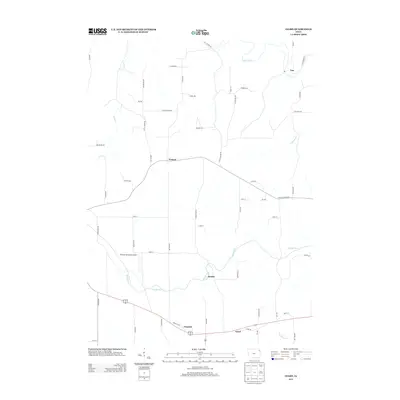
2013 Map of Giard
USGS Topo · Published 2013About this map
Bloody Run carves through the landscape of northeastern Iowa, defining the drainage patterns south of Watson. This 2013 survey illustrates a rural section of Allamakee County where small settlements like Beulah and Froelich are linked by a network of local roads. In the northern reaches, the Yellow River flows near the community of Ion, while the southern portion of the map is marked by the presence of Giard and the headwaters of Sny Magill Cr. The transport infrastructure includes the Monona Municipal Airport and uniquely named thoroughfares such as Spook Cave Rd and Old Mission Rd, suggesting the area's geological and cultural history. The terrain is characterized by numerous creek valleys, including Suttle Cr and Dousman Cr, which separate the agricultural plateaus and timbered hollows typical of this corner of the state.
Find a feature on this map
55 named features on this map. Tap any name to fly to it.
Don’t see what you’re looking for? This feature index may not catch every label — zoom into the map to look around manually.
Map Details
Editions of this 2013 Giard Map
This is the sole edition of this map. No revisions or reprints were ever made.
Other maps of this area

1902 · Elkader
USGS Topo · 1:125,000

1903 · Waukon
USGS Topo · 1:125,000

1929 · Prairie Du Chien
USGS Topo · 1:62,500

1932 · Prairie Du Chien
USGS Topo · 1:62,500

1958 · La Crosse
USGS Topo · 1:250,000

1959 · Dubuque
USGS Topo · 1:250,000

1961 · Dubuque
USGS Topo · 1:250,000

1961 · La Crosse
USGS Topo · 1:250,000

1962 · Dubuque
USGS Topo · 1:250,000

1962 · Clayton
USGS Topo · 1:24,000