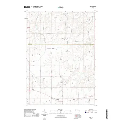
2018 Map of Giard
USGS Topo · Published 2018About this map
Yellow River winds through the northern portion of this landscape, carving through the bluff country where the border of Allamakee and Clayton counties meets. The area is defined by a series of small, scattered settlements including Watson, Beulah, Giard, Froelich, and the village of Ion. These communities are connected by a network of rural routes such as Co Hwy X 32 and Pleasant Ridge Rd, illustrating the persistent agricultural and transit patterns of Northeast Iowa.
Find a feature on this map
65 named features on this map. Tap any name to fly to it.
Don’t see what you’re looking for? This feature index may not catch every label — zoom into the map to look around manually.
Map Details
Editions of this 2018 Giard Map
This is the sole edition of this map. No revisions or reprints were ever made.
Other maps of this area

1902 · Elkader
USGS Topo · 1:125,000

1903 · Waukon
USGS Topo · 1:125,000

1929 · Prairie Du Chien
USGS Topo · 1:62,500

1932 · Prairie Du Chien
USGS Topo · 1:62,500

1958 · La Crosse
USGS Topo · 1:250,000

1959 · Dubuque
USGS Topo · 1:250,000

1961 · Dubuque
USGS Topo · 1:250,000

1961 · La Crosse
USGS Topo · 1:250,000

1962 · Dubuque
USGS Topo · 1:250,000

1962 · Clayton
USGS Topo · 1:24,000