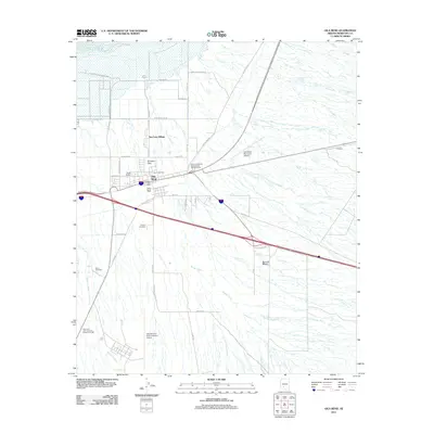
2011 Map of Gila Bend
USGS Topo · Published 2011About this map
Gila Bend serves as a critical desert crossroads in this early 21st-century record, where the transition from irrigated agriculture to the open Sonoran Desert is clearly marked. The settlement pattern is anchored by the historic town center and the nearby San Lucy Village, while the surrounding landscape is defined by the ephemeral drainage of Bender Wash and the northern presence of the Gila River.
Find a feature on this map
43 named features on this map. Tap any name to fly to it.
Don’t see what you’re looking for? This feature index may not catch every label — zoom into the map to look around manually.
Map Details
Editions of this 2011 Gila Bend Map
This is the sole edition of this map. No revisions or reprints were ever made.
Other maps of this area

1950 · Theba
USGS Topo · 1:62,500

1951 · Gila Bend
USGS Topo · 1:62,500

1951 · Theba
USGS Topo · 1:62,500

1951 · Cotton Center
USGS Topo · 1:62,500

1951 · Woolsey Peak
USGS Topo · 1:62,500

1953 · Ajo
USGS Topo · 1:250,000

1954 · Phoenix
USGS Topo · 1:250,000

1957 · Ajo
USGS Topo · 1:250,000

1957 · Phoenix
USGS Topo · 1:250,000

1958 · Ajo
USGS Topo · 1:250,000
Featured Places
- Gila Bend, AZ
- San Lucy District, AZ
- San Lucy Village, San Lucy District
- Maricopa County, AZ
- United States