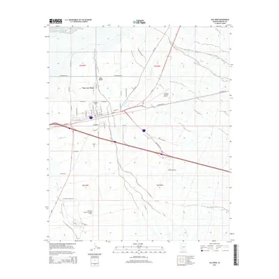
2014 Map of Gila Bend
USGS Topo · Published 2014About this map
Gila Bend serves as a critical desert junction in the early 21st century, where the intricate network of the Gila Bend Canal meets major transportation corridors. The landscape is defined by the ephemeral hydrology of the Sonoran Desert, with Bender Wash and Sand Tank Wash cutting through the arid terrain. Settlement patterns are concentrated around the town core and San Lucy Village, while the surrounding area is anchored by significant aviation infrastructure, including the Gila Bend Municipal Airport and the Gila Bend Air Force Auxiliary Airport. Local heritage is preserved at sites like Pioneer Cem and Stout Cem, which sit alongside established community spaces such as Burleson Park and Unity Park. The layout of modern thoroughfares like Az-85 and S Butterfield Trl mirrors older routes, such as Old Highway 84, illustrating the enduring importance of this passage through the Maricopa County desert.
Find a feature on this map
40 named features on this map. Tap any name to fly to it.
Don’t see what you’re looking for? This feature index may not catch every label — zoom into the map to look around manually.
Map Details
Editions of this 2014 Gila Bend Map
This is the sole edition of this map. No revisions or reprints were ever made.
Other maps of this area

1950 · Theba
USGS Topo · 1:62,500

1951 · Gila Bend
USGS Topo · 1:62,500

1951 · Theba
USGS Topo · 1:62,500

1951 · Cotton Center
USGS Topo · 1:62,500

1951 · Woolsey Peak
USGS Topo · 1:62,500

1953 · Ajo
USGS Topo · 1:250,000

1954 · Phoenix
USGS Topo · 1:250,000

1957 · Ajo
USGS Topo · 1:250,000

1957 · Phoenix
USGS Topo · 1:250,000

1958 · Ajo
USGS Topo · 1:250,000
Featured Places
- Gila Bend, AZ
- San Lucy District, AZ
- San Lucy Village, San Lucy District
- Maricopa County, AZ
- United States