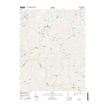
2014 Map of Gilbert
USGS Topo · Published 2014About this map
The Guyandotte River cuts a deep path through Mingo, Wyoming, and McDowell counties, serving as the central artery for this mountainous region of West Virginia. In the north, the town of Gilbert sits near the confluence of several tributaries, including Gilbert Creek and Stafford Branch. The landscape is defined by its complex drainage network, where hollows like Argus Hollow and Canebrake Hollow lead down to the river valley. The creation of R. D. Bailey Lake behind the R.D.Bailey Lake Dam has fundamentally altered the local geography, creating a recreation-focused corridor along the R D Bailey Highway. Numerous family cemeteries, such as Oak Log Cemetery and the Lester Cemetery, are scattered across the ridges and hollows, preserving a record of the area's ancestral settlements like North Spring and Steeles. Modern infrastructure is represented by the Rodney Staton Memorial Bridge and the James H Buck Harless Bridge, connecting these communities across the difficult terrain.
Find a feature on this map
104 named features on this map. Tap any name to fly to it.
Don’t see what you’re looking for? This feature index may not catch every label — zoom into the map to look around manually.
Map Details
Editions of this 2014 Gilbert Map
This is the sole edition of this map. No revisions or reprints were ever made.
Other maps of this area

1891 · Tazewell
USGS Topo · 1:125,000

1891 · Oceana
USGS Topo · 1:125,000

1893 · Oceana
USGS Topo · 1:125,000

1895 · Tazewell
USGS Topo · 1:125,000

1897 · Tazewell
USGS Topo · 1:125,000

1898 · Oceana
USGS Topo · 1:125,000

1909 · Gilbert
USGS Topo · 1:48,000

1910 · Pineville
USGS Topo · 1:48,000

1910 · Iaeger
USGS Topo · 1:48,000

1912 · Gilbert
USGS Topo · 1:62,500