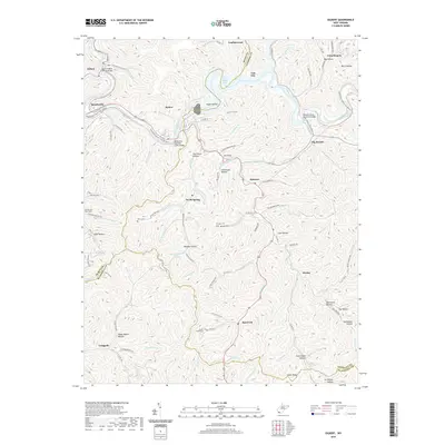
2019 Map of Gilbert
USGS Topo · Published 2019About this map
The Guyandotte River carves a winding path through this corner of Mingo and Wyoming Counties, defining a landscape dominated by narrow valleys and named hollows. The river is the focal point for modern recreation and historic transit, featuring the Guyandotte Water Trail and crossings such as the Harless Bridge and the Rodney Staton Memorial Bridge. Small settlements like Gilbert, North Spring, and Hanover are tied together by a network of hollows including Argus Hollow and Morgan Hollow.
Find a feature on this map
126 named features on this map. Tap any name to fly to it.
Don’t see what you’re looking for? This feature index may not catch every label — zoom into the map to look around manually.
Map Details
Editions of this 2019 Gilbert Map
This is the sole edition of this map. No revisions or reprints were ever made.
Other maps of this area

1891 · Tazewell
USGS Topo · 1:125,000

1891 · Oceana
USGS Topo · 1:125,000

1893 · Oceana
USGS Topo · 1:125,000

1895 · Tazewell
USGS Topo · 1:125,000

1897 · Tazewell
USGS Topo · 1:125,000

1898 · Oceana
USGS Topo · 1:125,000

1909 · Gilbert
USGS Topo · 1:48,000

1910 · Pineville
USGS Topo · 1:48,000

1910 · Iaeger
USGS Topo · 1:48,000

1912 · Gilbert
USGS Topo · 1:62,500