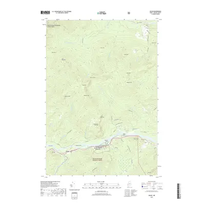
2018 Map of Gilead
USGS Topo · Published 2018About this map
The Androscoggin River carves a deep valley through the northern reaches of the White Mountain National Forest, anchoring the small settlement of Gilead in this 2018 survey. The landscape is defined by its significant relief, with prominent peaks like Lary Brook Mtn, Robinson Peak, and Tumbledown Dick Mtn rising above the river bottom. To the north, the Appalachian National Scenic Trail traverses the high ridges near Goose Eye and Jakes Notch. This region’s heritage is visible in the scattered river islands like Peabody Island and Philbrook Island, as well as the historic Peabody Cem and Chapman Cem situated along the valley floor. The confluence of the Wild River and the Androscoggin emphasizes the importance of water drainage patterns in this heavily forested part of Oxford County.
Find a feature on this map
56 named features on this map. Tap any name to fly to it.
Don’t see what you’re looking for? This feature index may not catch every label — zoom into the map to look around manually.
Map Details
Editions of this 2018 Gilead Map
This is the sole edition of this map. No revisions or reprints were ever made.
Other maps of this area

1893 · Gorham
USGS Topo · 1:62,500

1896 · Gorham
USGS Topo · 1:62,500

1914 · Bethel
USGS Topo · 1:62,500

1930 · Milan
USGS Topo · 1:62,500

1933 · Milan
USGS Topo · 1:62,500

1934 · Milan
USGS Topo · 1:62,500

1937 · Gorham
USGS Topo · 1:48,000

1940 · Bethel
USGS Topo · 1:62,500

1941 · Bethel
USGS Topo · 1:62,500

1942 · Gorham
USGS Topo · 1:62,500