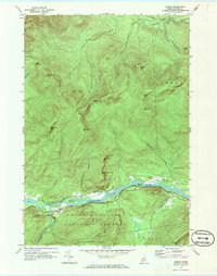
1970 Map of Gilead
USGS Topo · Published 1972About this map
Gilead serves as the primary hub of activity on this 1970s landscape, situated where the Wild River joins the Androscoggin River. This confluence area is marked by a complex network of transportation and infrastructure, including the Trunk Road and a Gaging Sta. The river is punctuated by large landforms such as Peabody Island and Blake Island, while a Picnic Area highlights the recreational utility of the riverbanks within the White Mountain National Forest.
Find a feature on this map
50 named features on this map. Tap any name to fly to it.
Don’t see what you’re looking for? This feature index may not catch every label — zoom into the map to look around manually.
Map Details
Editions of this 1970 Gilead Map
This is the sole edition of this map. No revisions or reprints were ever made.
Other maps of this area

1893 · Gorham
USGS Topo · 1:62,500

1896 · Gorham
USGS Topo · 1:62,500

1914 · Bethel
USGS Topo · 1:62,500

1930 · Milan
USGS Topo · 1:62,500

1933 · Milan
USGS Topo · 1:62,500

1934 · Milan
USGS Topo · 1:62,500

1937 · Gorham
USGS Topo · 1:48,000

1940 · Bethel
USGS Topo · 1:62,500

1941 · Bethel
USGS Topo · 1:62,500

1942 · Gorham
USGS Topo · 1:62,500