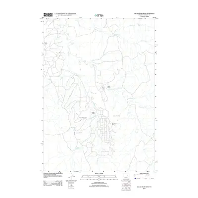
2012 Map of Gillam Draw West
USGS Topo · Published 2012About this map
The Naval Petroleum Reserve Number 3 and the East Teapot Dome Oil Field define the industrial and strategic character of this Natrona County landscape. Located in a region defined by its energy production history, the map shows a network of access routes like Naval Rd and various unnamed tracks that serve the oil infrastructure near Little Pine Ridge. Drainage patterns are dominated by the winding course of Salt Creek and Teapot Creek, which feed into localized storage including Conley Reservoir and Teapot Reservoir.
Find a feature on this map
18 named features on this map. Tap any name to fly to it.
Don’t see what you’re looking for? This feature index may not catch every label — zoom into the map to look around manually.
Map Details
Editions of this 2012 Gillam Draw West Map
This is the sole edition of this map. No revisions or reprints were ever made.
Other maps of this area

1955 · Arminto
USGS Topo · 1:250,000

1958 · Arminto
USGS Topo · 1:250,000

1959 · Edgerton
USGS Topo · 1:62,500

1959 · Ormsby Draw
USGS Topo · 1:62,500

1962 · Arminto
USGS Topo · 1:250,000

1968 · Midwest
USGS Topo · 1:24,000

1968 · Salt Creek
USGS Topo · 1:24,000
1968 · Teapot Rock
USGS Topo · 1:24,000
1981 · Midwest
USGS Topo · 1:100,000
1984 · Edgerton
USGS Topo · 1:24,000