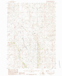
1984 Map of Gillam Draw West
USGS Topo · Published 1984About this map
Naval Petroleum (Teapot Dome) Reserve No 3 occupies a significant portion of this Natrona County landscape, marking the site of one of the most famous political scandals in American history. By the mid-1980s, the terrain shows a complex network of resource management and topographical landmarks. The drainage patterns of Teapot Creek and Little Teapot Creek dictate the local geography, while Little Pine Ridge provides a prominent elevated boundary to the east. Water resources in this arid environment are noted through features like Conley Res and the winding path of Salt Creek. Distinctive geological markers such as Castle Rock and Saddle Rock serve as essential orientation points within the high plains territory. The map details the transition from the rugged draws like Gillam Draw to the creek beds of Big Bull Cedar Creek, reflecting the area's history as a strategic petroleum reserve.
Find a feature on this map
15 named features on this map. Tap any name to fly to it.
Don’t see what you’re looking for? This feature index may not catch every label — zoom into the map to look around manually.
Map Details
Editions of this 1984 Gillam Draw West Map
This is the sole edition of this map. No revisions or reprints were ever made.
Other maps of this area

1955 · Arminto
USGS Topo · 1:250,000

1958 · Arminto
USGS Topo · 1:250,000

1959 · Edgerton
USGS Topo · 1:62,500

1959 · Ormsby Draw
USGS Topo · 1:62,500

1962 · Arminto
USGS Topo · 1:250,000

1968 · Midwest
USGS Topo · 1:24,000

1968 · Salt Creek
USGS Topo · 1:24,000
1968 · Teapot Rock
USGS Topo · 1:24,000
1981 · Midwest
USGS Topo · 1:100,000
1984 · Edgerton
USGS Topo · 1:24,000