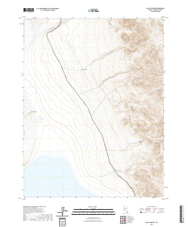
2021 Map of Gillis Canyon
USGS Topo · Published 2021About this map
Walker Lake dominates the southwestern corner of this survey, where the terminal waters meet the desert edge at Pelican Point. This arid landscape in Mineral County is defined by the sharp transition from the riparian corridor of the Walker River to the steep, rising elevations of the Gillis Range. The map details a complex network of public land divisions, including t12n r29e and t11n r30e, illustrating how the territory is segmented for resource management. Beyond the shoreline, the terrain is carved by deep drainage systems like Gillis Canyon and Wildhorse Canyon. Modern infrastructure is sparse, represented primarily by isolated tracks such as Ghost Dance Ln and Wildhorse Cyn Rd, reflecting the remote and undeveloped character of this Great Basin environment.
Find a feature on this map
14 named features on this map. Tap any name to fly to it.
Don’t see what you’re looking for? This feature index may not catch every label — zoom into the map to look around manually.
Map Details
Editions of this 2021 Gillis Canyon Map
This is the sole edition of this map. No revisions or reprints were ever made.
Other maps of this area

1909 · Hawthorne
USGS Topo · 1:250,000

1911 · Hawthorne
USGS Topo · 1:250,000

1915 · Hawthorne
USGS Topo · 1:250,000

1948 · Walker Lake
USGS Topo · 1:250,000

1955 · Hawthorne
USGS Topo · 1:62,500

1956 · Mt. Grant
USGS Topo · 1:62,500

1957 · Walker Lake
USGS Topo · 1:250,000

1962 · Walker Lake
USGS Topo · 1:250,000

1964 · Walker Lake
USGS Topo · 1:250,000

1964 · Gillis Canyon
USGS Topo · 1:62,500