
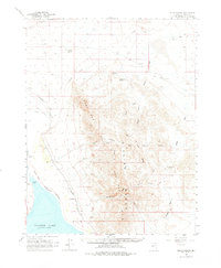
1964 Map of Gillis Canyon
USGS Topo · Published 1966About this map
Walker Lake anchors the southwestern corner of this desert landscape, its depths recorded from 1957 U.S. Navy hydrographic data. The shoreline at Pelican Point meets the Walker River Indian Reservation Boundary, tracing where the Walker River feeds the basin. The high terrain is dominated by the Gillis Range, a complex of peaks and canyons including Gillis Canyon and Wildhorse Canyon. Industrial activity is evident in the northern reaches, where the Red Granite Mine and Gentry Mine sit tucked within the ridges.
Find a feature on this map
22 named features on this map. Tap any name to fly to it.
Don’t see what you’re looking for? This feature index may not catch every label — zoom into the map to look around manually.
Map Details
Editions of this 1964 Gillis Canyon Map
2 editions found
Other maps of this area

1908 · Carson Sink
USGS Topo · 1:250,000

1909 · Hawthorne
USGS Topo · 1:250,000

1910 · Carson Sink
USGS Topo · 1:250,000

1911 · Hawthorne
USGS Topo · 1:250,000

1915 · Hawthorne
USGS Topo · 1:250,000

1948 · Walker Lake
USGS Topo · 1:250,000

1951 · Allen Springs
USGS Topo · 1:62,500

1951 · Weber Reservoir
USGS Topo · 1:62,500

1955 · Hawthorne
USGS Topo · 1:62,500

1956 · Mt. Grant
USGS Topo · 1:62,500