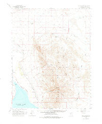
1964 Map of Gillis Canyon
USGS Topo · Published 1977About this map
Walker Lake and the Walker River delta anchor the southwestern corner of this mid-1960s survey, where the water meets the arid Agai Pah Range. The landscape is defined by the transition from the lake's shoreline at Pelican Point to the high desert peaks of the Agai Pah Hills. Transportation and resource extraction patterns are clearly visible through the Southern Pacific tracks skirting the lake and an Old Railroad Grade further north. Industrial activity is centered around the Red Granite Mine and Gentry Mine, while the small settlement of Nolan provides a rare point of habitation near the rail line. The map also delineates the Indian Reservation Boundary (Indefinite) as it cuts through the canyons and washes, including Gillis Canyon and Ghost Canyon, reflecting the complex land management of this Mineral County region.
Find a feature on this map
25 named features on this map. Tap any name to fly to it.
Don’t see what you’re looking for? This feature index may not catch every label — zoom into the map to look around manually.
Map Details
Editions of this 1964 Gillis Canyon Map
2 editions found

Other maps of this area

1908 · Carson Sink
USGS Topo · 1:250,000

1909 · Hawthorne
USGS Topo · 1:250,000

1910 · Carson Sink
USGS Topo · 1:250,000

1911 · Hawthorne
USGS Topo · 1:250,000

1915 · Hawthorne
USGS Topo · 1:250,000

1948 · Walker Lake
USGS Topo · 1:250,000

1951 · Allen Springs
USGS Topo · 1:62,500

1951 · Weber Reservoir
USGS Topo · 1:62,500

1955 · Hawthorne
USGS Topo · 1:62,500

1956 · Mt. Grant
USGS Topo · 1:62,500