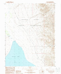
1988 Map of Gillis Canyon
USGS Topo · Published 1988About this map
Walker River Indian Reservation lands dominate this central Nevada landscape, where the Walker River flows into the northern reaches of Walker Lake. The shoreline is marked by Pelican Point, providing a glimpse into the hydrography of the region as it was recorded in the mid-1980s. To the east, the topography rises sharply into the Agai Pah Range and Gillis Hills, terrain characterized by deep cuts like Wildhorse Canyon. Human infrastructure is sparse but critical to the era, defined by the Southern Pacific railroad corridor and utility routes including a Telephone line and Transmission Line that skirt the base of the mountains. Several Prospect markings in the high country suggest the mineral exploration history common to the Mineral County area, while the presence of an Alkali Flat north of the river highlights the arid, terminal-basin environment.
Find a feature on this map
15 named features on this map. Tap any name to fly to it.
Don’t see what you’re looking for? This feature index may not catch every label — zoom into the map to look around manually.
Map Details
Editions of this 1988 Gillis Canyon Map
This is the sole edition of this map. No revisions or reprints were ever made.
Other maps of this area

1909 · Hawthorne
USGS Topo · 1:250,000

1911 · Hawthorne
USGS Topo · 1:250,000

1915 · Hawthorne
USGS Topo · 1:250,000

1948 · Walker Lake
USGS Topo · 1:250,000

1955 · Hawthorne
USGS Topo · 1:62,500

1956 · Mt. Grant
USGS Topo · 1:62,500

1957 · Walker Lake
USGS Topo · 1:250,000

1962 · Walker Lake
USGS Topo · 1:250,000

1964 · Walker Lake
USGS Topo · 1:250,000

1964 · Gillis Canyon
USGS Topo · 1:62,500