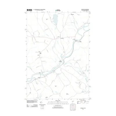
2012 Map of Gilman
USGS Topo · Published 2012About this map
The Connecticut River defines the valley floor of this 2012 survey, winding past the village of Lunenburg and the smaller settlements of South Lunenburg and Gilman. The landscape is marked by a network of rural roads that serve the hillside communities and cemeteries, including Lunenburg Corner Cem and Riverside Cem, which offer significant genealogical value for researchers of the Vermont-New Hampshire border. Notable landmarks like the Mount Orne Covered Bridge cross the river into South Lancaster, while to the north, Neal Pond and its surrounding camps remain a local focal point for recreation.
Find a feature on this map
88 named features on this map. Tap any name to fly to it.
Don’t see what you’re looking for? This feature index may not catch every label — zoom into the map to look around manually.
Map Details
Editions of this 2012 Gilman Map
This is the sole edition of this map. No revisions or reprints were ever made.
Other maps of this area

1900 · Whitefield
USGS Topo · 1:62,500

1920 · Guildhall
USGS Topo · 1:62,500

1931 · Guildhall
USGS Topo · 1:48,000

1931 · Littleton
USGS Topo · 1:62,500

1932 · Littleton
USGS Topo · 1:48,000

1933 · Guildhall
USGS Topo · 1:48,000

1935 · Littleton
USGS Topo · 1:62,500

1935 · Whitefield
USGS Topo · 1:48,000

1937 · Guildhall
USGS Topo · 1:62,500

1938 · Whitefield
USGS Topo · 1:62,500