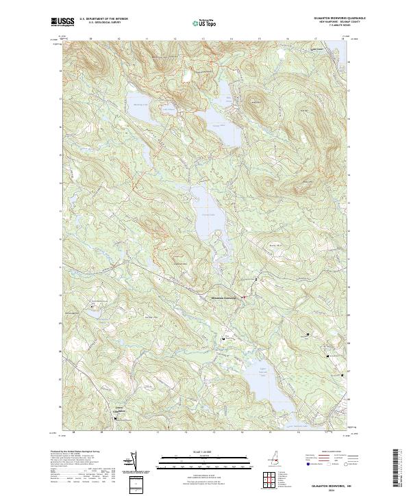
2024 Map of Gilmanton Ironworks
USGS Topo · Published 2024About this map
Gilmanton Ironworks serves as the focal point of this Belknap County landscape, situated where the Suncook River flows from Crystal Lake. The village and its surrounding rural corridors reveal a deep-seated New England settlement pattern defined by numerous family burial grounds and meeting houses. Genealogists will find significant value in the documentation of the Smith Meeting House Cem, the Sleeper Burial Ground, and the Pickering Lot Cem, which sit alongside historic routes like Province Rd and Stage Rd. To the north, the terrain rises into the Belknap Mountains and Guinea Ridge, sheltering smaller water bodies such as Manning Lake and Lake Eileen. The southern portion of the map is dominated by the expansive Upper Suncook Lake and Lower Suncook Lake, illustrating the connection between the region's topography and its significant water resources.
Find a feature on this map
121 named features on this map. Tap any name to fly to it.
Don’t see what you’re looking for? This feature index may not catch every label — zoom into the map to look around manually.
Map Details
Editions of this 2024 Gilmanton Ironworks Map
This is the sole edition of this map. No revisions or reprints were ever made.
Other maps of this area

1909 · Winnepesaukee
USGS Topo · 1:62,500

1919 · Gilmanton
USGS Topo · 1:62,500

1919 · Alton
USGS Topo · 1:62,500

1927 · Gilmanton
USGS Topo · 1:62,500

1928 · Wolfeboro
USGS Topo · 1:62,500

1949 · Portland
USGS Topo · 1:250,000

1956 · Winnipesaukee
USGS Topo · 1:62,500

1956 · Portland
USGS Topo · 1:250,000

1957 · Alton
USGS Topo · 1:62,500
1957 · Gilmanton
USGS Topo · 1:62,500