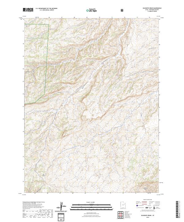
2023 Map of Gilsonite Draw
USGS Topo · Published 2023About this map
Ashley National Forest encompasses the northwestern portion of this Duchesne County landscape, where the high plateau begins its descent into a complex network of arid drainage systems. The map is defined by deep, winding incisions including Gilsonite Draw and Fivemile Canyon, which carve through the high desert toward the southern boundary. This topography is anchored by the Bad Land Cliffs in the southeast, a significant escarpment that dictates the flow of local hydrology such as Big Wash and Gate Canyon. Transportation in this remote area is primarily confined to canyon floors, most notably along Nine Mile Canyon Rd, which serves as the primary artery through this rugged vertical terrain. Smaller routes like Cactus Rd and Eagle Perch Rd provide limited access to the higher elevations between Wells Draw and the surrounding tablelands.
Find a feature on this map
10 named features on this map. Tap any name to fly to it.
Don’t see what you’re looking for? This feature index may not catch every label — zoom into the map to look around manually.
Map Details
Editions of this 2023 Gilsonite Draw Map
This is the sole edition of this map. No revisions or reprints were ever made.
Other maps of this area

1885 · Uinta
USGS Topo · 1:250,000

1886 · Price River
USGS Topo · 1:250,000

1896 · Price River
USGS Topo · 1:250,000

1939 · Duchesne
USGS Topo · 1:125,000

1954 · Salt Lake City
USGS Topo · 1:250,000

1956 · Price
USGS Topo · 1:250,000

1958 · Salt Lake City
USGS Topo · 1:250,000

1960 · Salt Lake City
USGS Topo · 1:250,000

1960 · Price
USGS Topo · 1:250,000

1962 · Price
USGS Topo · 1:250,000