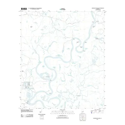
2011 Map of Ginhouse Island
USGS Topo · Published 2011About this map
The Tombigbee River dominates this riverine landscape, carving a complex path of oxbows and secondary channels through the Alabama backcountry. Significant riverside features like Oven Bluff and McIntosh Bluff provide rare high ground along the winding waterway. The map reveals a specialized river-based economy, evidenced by several active landing points including Oven Landing, Batchelors Landing, and Berris Landing.
Find a feature on this map
62 named features on this map. Tap any name to fly to it.
Don’t see what you’re looking for? This feature index may not catch every label — zoom into the map to look around manually.
Map Details
Editions of this 2011 Ginhouse Island Map
This is the sole edition of this map. No revisions or reprints were ever made.
Other maps of this area

1943 · Choctaw Bluff
USGS Topo · 1:62,500

1943 · Tensaw
USGS Topo · 1:62,500

1943 · Citronelle
USGS Topo · 1:62,500

1943 · McIntosh
USGS Topo · 1:62,500

1944 · McIntosh
USGS Topo · 1:62,500

1944 · Tensaw
USGS Topo · 1:62,500

1946 · Citronelle
USGS Topo · 1:62,500

1946 · Choctaw Bluff
USGS Topo · 1:62,500

1953 · Andalusia
USGS Topo · 1:250,000

1953 · Hattiesburg
USGS Topo · 1:250,000