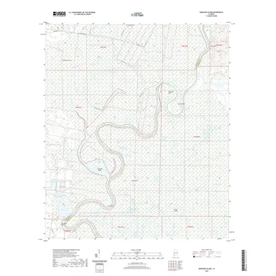
2020 Map of Ginhouse Island
USGS Topo · Published 2020About this map
The Tombigbee River snakes through a dense network of bottomland swamps and bayous along the Washington and Clarke county line. This riverine landscape is defined by its complex hydrology, featuring numerous cut-off lakes and secondary channels like Ginhouse Lake, Green Lake, and Otter Bayou. The elevation remains low, as evidenced by the expansive Mud Swamp and the presence of named landmasses within the floodplain such as Ginhouse Island and Monger Island.
Find a feature on this map
58 named features on this map. Tap any name to fly to it.
Don’t see what you’re looking for? This feature index may not catch every label — zoom into the map to look around manually.
Map Details
Editions of this 2020 Ginhouse Island Map
This is the sole edition of this map. No revisions or reprints were ever made.
Other maps of this area

1943 · Choctaw Bluff
USGS Topo · 1:62,500

1943 · Tensaw
USGS Topo · 1:62,500

1943 · Citronelle
USGS Topo · 1:62,500

1943 · McIntosh
USGS Topo · 1:62,500

1944 · McIntosh
USGS Topo · 1:62,500

1944 · Tensaw
USGS Topo · 1:62,500

1946 · Citronelle
USGS Topo · 1:62,500

1946 · Choctaw Bluff
USGS Topo · 1:62,500

1953 · Andalusia
USGS Topo · 1:250,000

1953 · Hattiesburg
USGS Topo · 1:250,000