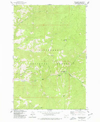
1974 Map of Gird Point
USGS Topo · Published 1977About this map
Bitterroot National Forest dominates this mid-1970s survey, illustrating a landscape defined by forest management and watershed geography. The confluence of Skalkaho Creek and several steep drainages like Daly Creek and Bear Gulch highlights the area's intricate drainage pattern. Human presence is centered on federal land administration and recreational infrastructure, notably at the Black Bear Forest Service Station and the nearby Black Bear Campground.
Find a feature on this map
28 named features on this map. Tap any name to fly to it.
Don’t see what you’re looking for? This feature index may not catch every label — zoom into the map to look around manually.
Map Details
Editions of this 1974 Gird Point Map
This is the sole edition of this map. No revisions or reprints were ever made.
Other maps of this area

1901 · Hamilton
USGS Topo · 1:125,000

1909 · Sapphire
USGS Topo · 1:125,000

1947 · Butte
USGS Topo · 1:250,000

1956 · Hamilton
USGS Topo · 1:250,000

1958 · Butte
USGS Topo · 1:250,000

1959 · Hamilton
USGS Topo · 1:250,000

1960 · Butte
USGS Topo · 1:250,000

1960 · Hamilton
USGS Topo · 1:250,000

1962 · Butte
USGS Topo · 1:250,000

1964 · Hamilton
USGS Topo · 1:250,000