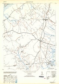
1953 Map of Girdletree
USGS Topo · Published 1953About this map
Girdletree and Stockton anchor this survey of the lower Delmarva Peninsula, where the landscape is defined by the Pennsylvania Railroad and a network of intricate waterways. The map documents the rural settlement patterns along the Maryland and Virginia border, featuring many family and community landmarks such as Klej Grange and Welbourne. Local genealogy and social history are well-represented through numerous community hubs like St Pauls School, Shiloh Church, and the Betheden Cem. The terrain transitions from the marshy reaches of Holly Swamp and Swanscut Creek to the coastal ports of Greenbackville and Franklin City on the Chincoteague Bay. This survey captures the region before extensive modern development, preserving the locations of numerous ditches and branches like Rayfield Ditch and Little Mill Run that once drove the local drainage and milling economy.
Find a feature on this map
73 named features on this map. Tap any name to fly to it.
Don’t see what you’re looking for? This feature index may not catch every label — zoom into the map to look around manually.
Map Details
Editions of this 1953 Girdletree Map
2 editions found
Other maps of this area

1901 · Snow Hill
USGS Topo · 1:62,500

1942 · Chincoteague East
USGS Topo · 1:24,000

1942 · Snow Hill
USGS Topo · 1:24,000

1942 · Wesley
USGS Topo · 1:24,000

1942 · Dividing Creek
USGS Topo · 1:24,000

1943 · Snow Hill
USGS Topo · 1:31,680

1943 · Boxiron
USGS Topo · 1:31,680

1943 · Dividing Creek
USGS Topo · 1:31,680
1943 · Wesley
USGS Topo · 1:31,680

1943 · Chincoteague West
USGS Topo · 1:31,680