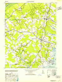
1953 Map of Girdletree
USGS Topo · Published 1953About this map
Girdletree and Stockton anchor this survey of the Eastern Shore, illustrating a landscape defined by tidewater inlets and a network of drainage ditches vital to coastal agriculture. Along the southern edge, the Maryland Virginia state line is marked by the MD-VA Boundary Mon Davis, dividing the communities of Franklin City and Greenbackville near the shores of Purnell Bay. The interior is crisscrossed by an extensive system of waterways and man-made channels like Marshall Ditch and Rayfield Ditch, which manage the low-lying terrain around Holly Swamp.
Find a feature on this map
66 named features on this map. Tap any name to fly to it.
Don’t see what you’re looking for? This feature index may not catch every label — zoom into the map to look around manually.
Map Details
Editions of this 1953 Girdletree Map
2 editions found
Other maps of this area

1901 · Snow Hill
USGS Topo · 1:62,500

1942 · Chincoteague East
USGS Topo · 1:24,000

1942 · Snow Hill
USGS Topo · 1:24,000

1942 · Wesley
USGS Topo · 1:24,000

1942 · Dividing Creek
USGS Topo · 1:24,000

1943 · Snow Hill
USGS Topo · 1:31,680

1943 · Boxiron
USGS Topo · 1:31,680

1943 · Dividing Creek
USGS Topo · 1:31,680
1943 · Wesley
USGS Topo · 1:31,680

1943 · Chincoteague West
USGS Topo · 1:31,680