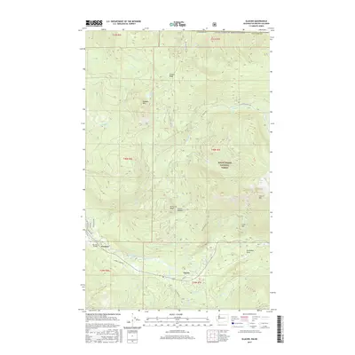
2017 Map of Glacier
USGS Topo · Published 2017About this map
Glacier and the smaller settlement of Warnick anchor this mountainous section of Whatcom County, situated just south of the United States and Canada border. The landscape is dominated by the steep peaks of the Mount Baker National Forest, including Church Mountain and Kaisoots Mountain. The drainage patterns are defined by the North Fork Nooksack River, which creates a distinctive Horseshoe Bend as it flows westward through the valley. Local infrastructure focuses on forest access and small-scale residential pockets, evidenced by Canyon Creek Road and the Warnick Bridge. High-altitude features like Kidney Lakes and Bald Lake punctuate the ridges, while established landmarks such as Church Saddle provide orientation for those navigating the complex terrain between West Church Ridge and the northern borderlands.
Find a feature on this map
51 named features on this map. Tap any name to fly to it.
Don’t see what you’re looking for? This feature index may not catch every label — zoom into the map to look around manually.
Map Details
Editions of this 2017 Glacier Map
This is the sole edition of this map. No revisions or reprints were ever made.
Other maps of this area

1909 · Mt Baker
USGS Topo · 1:192,000

1915 · Mt. Baker
USGS Topo · 1:250,000

1919 · Van Zandt
USGS Topo · 1:62,500

1951 · Van Zandt
USGS Topo · 1:62,500

1952 · Mt. Baker
USGS Topo · 1:62,500

1955 · Concrete
USGS Topo · 1:250,000

1957 · Victoria
USGS Topo · 1:250,000

1958 · Concrete
USGS Topo · 1:250,000

1962 · Concrete
USGS Topo · 1:250,000

1972 · Maple Falls
USGS Topo · 1:24,000