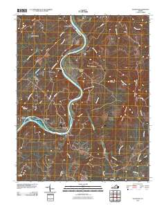
2010 Map of Gladstone
USGS Topo · Published 2010About this map
The James River carves a deep path through this central Virginia landscape, creating a corridor of transit and settlement at the start of the twenty-first century. The river dictates the placement of towns like Gladstone and Caskie, while various branches and creeks like David Creek and Alabama Creek drain the surrounding heights. The geography is defined by a series of distinct ridgelines and summits, including Spears Mountain to the east and Buffalo Ridge to the north. Smaller communities and crossroads like Four Forks, Greenway, and Buffalo Station are connected by a network of local routes such as Buffalo Station Dr and Turkey Rd. In the southern reaches, Bent Creek marks a significant confluence where the creek of the same name meets the river, situated near Tower Hill. This topography illustrates how local settlement patterns remained tethered to the river's path and the narrow valleys between the region's prominent mountains.
Find a feature on this map
40 named features on this map. Tap any name to fly to it.
Don’t see what you’re looking for? This feature index may not catch every label — zoom into the map to look around manually.
Map Details
Editions of this 2010 Gladstone Map
This is the sole edition of this map. No revisions or reprints were ever made.
Other maps of this area

1892 · Buckingham
USGS Topo · 1:125,000

1892 · Appomattox
USGS Topo · 1:125,000

1947 · Roanoke
USGS Topo · 1:250,000

1958 · Appomattox
USGS Topo · 1:62,500

1958 · Pamplin City
USGS Topo · 1:62,500

1959 · Roanoke
USGS Topo · 1:250,000

1961 · Shipman
USGS Topo · 1:62,500

1961 · Buckingham
USGS Topo · 1:62,500

1963 · Roanoke
USGS Topo · 1:250,000
1968 · Howardsville
USGS Topo · 1:24,000