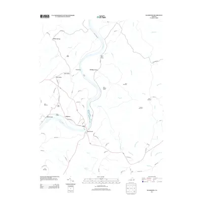
2013 Map of Gladstone
USGS Topo · Published 2013About this map
Gladstone and the surrounding riverfront settlements along the James River define this Central Virginia landscape in the early 21st century. The map illustrates a distinctive pattern of small communities such as Caskie, Bent Creek, and Greenway that follow the river's winding course. This era shows a well-developed secondary road network, including the Tye Yard Ramp and Buffalo Station Dr, connecting these historic hamlets to the higher elevations of Pruetts Mountain and Buck Mountain.
Find a feature on this map
75 named features on this map. Tap any name to fly to it.
Don’t see what you’re looking for? This feature index may not catch every label — zoom into the map to look around manually.
Map Details
Editions of this 2013 Gladstone Map
This is the sole edition of this map. No revisions or reprints were ever made.
Other maps of this area

1892 · Buckingham
USGS Topo · 1:125,000

1892 · Appomattox
USGS Topo · 1:125,000

1947 · Roanoke
USGS Topo · 1:250,000

1958 · Appomattox
USGS Topo · 1:62,500

1958 · Pamplin City
USGS Topo · 1:62,500

1959 · Roanoke
USGS Topo · 1:250,000

1961 · Shipman
USGS Topo · 1:62,500

1961 · Buckingham
USGS Topo · 1:62,500

1963 · Roanoke
USGS Topo · 1:250,000
1968 · Howardsville
USGS Topo · 1:24,000