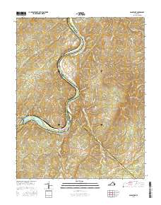
2016 Map of Gladstone
USGS Topo · Published 2016About this map
The James River carves a deep, winding path through the heart of the Virginia Piedmont, defining the boundaries of Nelson, Buckingham, Amherst, and Appomattox counties. This landscape is characterized by prominent ridges such as Buffalo Ridge and Bible Ridge, which hem in the river valley and its narrow floodplains where settlements like Gladstone and Caskie are situated. The presence of Smith Islands in the river channel indicates the dynamic fluvial environment that has historically influenced local transport and land use.
Find a feature on this map
71 named features on this map. Tap any name to fly to it.
Don’t see what you’re looking for? This feature index may not catch every label — zoom into the map to look around manually.
Map Details
Editions of this 2016 Gladstone Map
This is the sole edition of this map. No revisions or reprints were ever made.
Other maps of this area

1892 · Buckingham
USGS Topo · 1:125,000

1892 · Appomattox
USGS Topo · 1:125,000

1947 · Roanoke
USGS Topo · 1:250,000

1958 · Appomattox
USGS Topo · 1:62,500

1958 · Pamplin City
USGS Topo · 1:62,500

1959 · Roanoke
USGS Topo · 1:250,000

1961 · Shipman
USGS Topo · 1:62,500

1961 · Buckingham
USGS Topo · 1:62,500

1963 · Roanoke
USGS Topo · 1:250,000
1968 · Howardsville
USGS Topo · 1:24,000