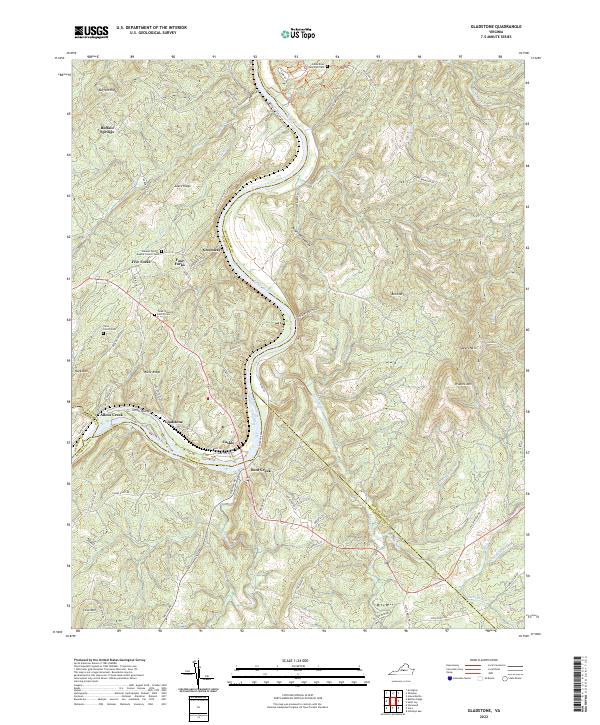
2022 Map of Gladstone
USGS Topo · Published 2022About this map
The James River winds through this Central Virginia landscape, carving a deep path between the ridges of the Piedmont. Centered on the settlement of Gladstone, the map documents a terrain defined by significant elevation changes, from the heights of Buffalo Ridge and Buck Mtn down to the river bottoms. This area serves as a junction for multiple counties, including Amherst, Nelson, Buckingham, and Appomattox, with the river acting as a natural boundary between them. Local heritage is deeply etched into the topography through several family and community burial sites, such as the Tyree Family Cem and the Mineral Springs Baptist Church Cem. Small communities like Buffalo Springs, Greenway, and Bent Creek are connected by a network of rural routes, including River RD and Gladstone RD, which follow the contours of the land and the historic river corridor.
Find a feature on this map
78 named features on this map. Tap any name to fly to it.
Don’t see what you’re looking for? This feature index may not catch every label — zoom into the map to look around manually.
Map Details
Editions of this 2022 Gladstone Map
This is the sole edition of this map. No revisions or reprints were ever made.
Other maps of this area

1892 · Buckingham
USGS Topo · 1:125,000

1892 · Appomattox
USGS Topo · 1:125,000

1947 · Roanoke
USGS Topo · 1:250,000

1958 · Appomattox
USGS Topo · 1:62,500

1958 · Pamplin City
USGS Topo · 1:62,500

1959 · Roanoke
USGS Topo · 1:250,000

1961 · Shipman
USGS Topo · 1:62,500

1961 · Buckingham
USGS Topo · 1:62,500

1963 · Roanoke
USGS Topo · 1:250,000
1968 · Howardsville
USGS Topo · 1:24,000