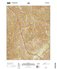
2019 Map of Gladys
USGS Topo · Published 2019About this map
Gladys and the surrounding rural communities of Campbell County are defined by a network of creeks and small crossroads settlements in this 2019 survey. The landscape is carved by Mollys Creek, Suck Cr, and the forks of Seneca Creek, which historically dictated the placement of early industry and habitation. Mitchell Mill sits at a low point in the west, while the northern reaches include the small clusters of Winfall and Three Forks. The terrain is predominantly agricultural and wooded, with homes and farms connected by winding roads like Winfall Rd and Collins Ferry Rd. In the southeast, the Brookneal/Campbell County Airport provides a modern logistical anchor, contrasting with the longstanding rural character of Mount Zion and Diamond Hill. These named places often correspond to historic church congregations or local family landholdings, preserving the identity of this Piedmont region.
Find a feature on this map
70 named features on this map. Tap any name to fly to it.
Don’t see what you’re looking for? This feature index may not catch every label — zoom into the map to look around manually.
Map Details
Editions of this 2019 Gladys Map
This is the sole edition of this map. No revisions or reprints were ever made.
Other maps of this area

1892 · Lynchburg
USGS Topo · 1:125,000

1892 · Appomattox
USGS Topo · 1:125,000

1944 · Lynchburg
USGS Topo · 1:62,500

1947 · Roanoke
USGS Topo · 1:250,000

1950 · Lynchburg
USGS Topo · 1:62,500

1956 · Brookneal
USGS Topo · 1:62,500

1956 · Gladys
USGS Topo · 1:62,500

1958 · Appomattox
USGS Topo · 1:62,500

1959 · Roanoke
USGS Topo · 1:250,000

1963 · Roanoke
USGS Topo · 1:250,000