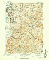
1953 Map of Glastonbury
USGS Topo · Published 1954About this map
The Connecticut River and its expansive Glastonbury Meadows anchor the western edge of this mid-century landscape, where suburban growth from East Hartford begins to press against the more rural, forested uplands to the east. Several named housing developments, including Welles Village, Forbes Village, and Forest Village, signal the era's residential expansion. Beyond these settlements, the topography rises sharply toward Minnechaug Mtn and Kongscut Mtn, revealing a complex network of brooks such as Salmon Brook and Roaring Brook that shaped the historical placement of mills and villages like Addison and Buckingham. Extensive woodland remains preserved within the Meshomasic State Forest in the south, while the historic corridor of the New London Turnpike cuts diagonally through the center. Numerous small burial grounds, such as Still Hill Cem and the Old Burying Cem, are scattered throughout, offering critical touchstones for local genealogical research.
Find a feature on this map
78 named features on this map. Tap any name to fly to it.
Don’t see what you’re looking for? This feature index may not catch every label — zoom into the map to look around manually.
Map Details
Editions of this 1953 Glastonbury Map
3 editions found
Other maps of this area

1892 · Hartford
USGS Topo · 1:62,500

1892 · Tolland
USGS Topo · 1:62,500

1892 · Gilead
USGS Topo · 1:62,500

1893 · Middletown
USGS Topo · 1:62,500

1906 · Farmington
USGS Topo · 1:125,000

1921 · Tolland
USGS Topo · 1:62,500

1928 · Cromwell
USGS Topo · 1:24,000

1928 · Windsor
USGS Topo · 1:24,000

1928 · Glastonbury
USGS Topo · 1:24,000

1928 · Manchester
USGS Topo · 1:24,000