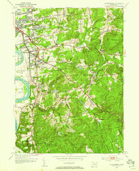
1953 Map of Glastonbury
USGS Topo · Published 1959About this map
The sprawling Glastonbury Meadows along the Connecticut River anchor this mid-century look at East Hartford and Glastonbury. Settlement patterns follow the river and the arterial roads leading east toward Minnechaug Mtn, where the landscape transitions from residential villages like Welles Village and Naubuc into the wooded uplands of the Meshomasic State Forest. Genealogists will find a wealth of burial grounds, including the Old Burying Cem and Glastonbury Green Cem, alongside numerous parish cemeteries such as St Augustine Cem. The presence of industrial and recreational water features like Shoddy Mill Pond and Treat Pond suggests the region's historical reliance on local waterways. In the north, Rentschler Airport stands near Forbes Village, marking the early aviation era in the Connecticut River valley.
Find a feature on this map
73 named features on this map. Tap any name to fly to it.
Don’t see what you’re looking for? This feature index may not catch every label — zoom into the map to look around manually.
Map Details
Editions of this 1953 Glastonbury Map
3 editions found
Other maps of this area

1892 · Hartford
USGS Topo · 1:62,500

1892 · Tolland
USGS Topo · 1:62,500

1892 · Gilead
USGS Topo · 1:62,500

1893 · Middletown
USGS Topo · 1:62,500

1906 · Farmington
USGS Topo · 1:125,000

1921 · Tolland
USGS Topo · 1:62,500

1928 · Cromwell
USGS Topo · 1:24,000

1928 · Windsor
USGS Topo · 1:24,000

1928 · Glastonbury
USGS Topo · 1:24,000

1928 · Manchester
USGS Topo · 1:24,000