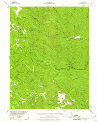
1943 Map of Glenblair
USGS Topo · Published 1960About this map
Glenblair and the winding course of the Noyo River define this 1943 topography, recorded just as wartime aerial photogrammetry began to refine the mapping of these dense coastal watersheds. The landscape is a map of the timber industry’s reach, showing numerous logging outposts and infrastructure like Old Camp 19 and Caspar Lumber Co Camp 20. The California Western Railroad snakes through the canyon, connecting isolated stations at Northspur and Irmulco to the broader coast. To the south, the village of Comptche serves as a hub for family holdings like the Grimes Ranch and Russel Ranch, while the McKay School highlights the established rural community. This survey, reprinted from a military edition, captures the intricate drainage systems of the Big River and Albion River, providing a detailed look at the ranches and lumber camps that once dominated the redwood country of Mendocino County.
Find a feature on this map
93 named features on this map. Tap any name to fly to it.
Don’t see what you’re looking for? This feature index may not catch every label — zoom into the map to look around manually.
Map Details
Editions of this 1943 Glenblair Map
2 editions found
Other maps of this area

1920 · Glenblair
USGS Topo · 1:62,500

1920 · Fort Bragg
USGS Topo · 1:62,500

1921 · Westport
USGS Topo · 1:62,500

1921 · Branscomb
USGS Topo · 1:62,500

1922 · Willits
USGS Topo · 1:62,500

1942 · Willits
USGS Topo · 1:62,500

1943 · Glenblair
USGS Topo · 1:62,500

1943 · Fort Bragg
USGS Topo · 1:62,500

1943 · Albion
USGS Topo · 1:62,500

1943 · Boonville
USGS Topo · 1:62,500