
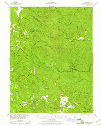
1943 Map of Glenblair
USGS Topo · Published 1943About this map
The California Western Railroad winds through the heavily forested interior of Mendocino County, connecting isolated lumber camps and rural outposts during the early 1940s. This survey, prepared by the Corps of Engineers, U. S. Army, illustrates a landscape deeply tied to the timber industry, marked by numerous logging camps such as Caspar Lumber Co Camp 20 and Old Camp 7. Settlements like Northspur and Irmulco serve as pivotal points along the rail line, while the southern portion of the map reveals a shift toward small-scale ranching and community life in Comptche, supported by the McKay School.
Find a feature on this map
57 named features on this map. Tap any name to fly to it.
Don’t see what you’re looking for? This feature index may not catch every label — zoom into the map to look around manually.
Map Details
Editions of this 1943 Glenblair Map
2 editions found
Other maps of this area

1920 · Glenblair
USGS Topo · 1:62,500

1920 · Fort Bragg
USGS Topo · 1:62,500

1921 · Westport
USGS Topo · 1:62,500

1921 · Branscomb
USGS Topo · 1:62,500

1922 · Willits
USGS Topo · 1:62,500

1942 · Willits
USGS Topo · 1:62,500

1943 · Fort Bragg
USGS Topo · 1:62,500

1943 · Albion
USGS Topo · 1:62,500

1943 · Boonville
USGS Topo · 1:62,500

1943 · Navarro
USGS Topo · 1:62,500