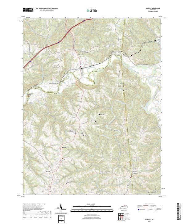
2022 Map of Glencoe
USGS Topo · Published 2022About this map
Glencoe and the surrounding tri-county region of Gallatin, Owen, and Grant counties are defined by the intricate winding waters of Eagle Creek and its many tributaries. This landscape, characterized by deep-cut drainages like No Head Hollow and ridges such as Micah's Ridge, reveals a pattern of ridge-top settlements and valley-floor farming. The map is particularly valuable for genealogical research, documenting several family and community burial grounds including the Asa Kemper Cem, Maddox Cem, and the specialized Poplar Grove Independent Order of Odd Fellows Cem. These sites, alongside the smaller hamlets of Poplar Grove, Bromley, and Jonesville, illustrate the persistent rural character of this Kentucky upland area. Modern transportation through I-71 and Us HWY 127 overlays an older network of routes like the Old Boone TRL, reflecting the long history of travel through these creek valleys.
Find a feature on this map
89 named features on this map. Tap any name to fly to it.
Don’t see what you’re looking for? This feature index may not catch every label — zoom into the map to look around manually.
Map Details
Editions of this 2022 Glencoe Map
This is the sole edition of this map. No revisions or reprints were ever made.
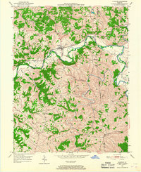
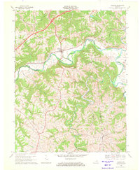
Historical Maps of Jonesville Through Time
3 maps found