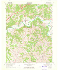
1969 Map of Glencoe
USGS Topo · Published 1971About this map
The sharp meanders of Eagle Creek carve a deep path through the hills of North Central Kentucky, defining the border between Gallatin and Owen Counties. This late 1960s survey documents the rural character of the area surrounding Glencoe, where the Louisville and Nashville railroad tracks parallel the water’s edge. The landscape is dotted with small hilltop and hollow settlements including Jonesville, Bromley, and Poplar Grove, often anchored by local landmarks like Oakland Ch and Pleasant Home Ch.
Find a feature on this map
33 named features on this map. Tap any name to fly to it.
Don’t see what you’re looking for? This feature index may not catch every label — zoom into the map to look around manually.
Map Details
Editions of this 1969 Glencoe Map
This is the sole edition of this map. No revisions or reprints were ever made.
Other maps of this area

1943 · Florence
USGS Topo · 1:24,000

1943 · Patriot
USGS Topo · 1:24,000

1950 · New Liberty
USGS Topo · 1:24,000

1950 · Glencoe
USGS Topo · 1:24,000

1950 · Elliston
USGS Topo · 1:24,000

1950 · Owenton
USGS Topo · 1:24,000

1950 · Verona
USGS Topo · 1:24,000

1950 · Lawrenceville
USGS Topo · 1:24,000

1951 · Florence
USGS Topo · 1:24,000

1951 · Sanders
USGS Topo · 1:24,000