
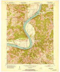
1950 Map of Verona
USGS Topo · Published 1952About this map
Verona serves as a central hub in this post-war landscape, where the Louisville and Nashville railroad cuts a diagonal path through the dissected hills of northern Kentucky. The map documents a deeply rural network of family-named cemeteries and country parishes, such as St Patricks Cem and Beaverlick Ch, which anchored small communities like Beaverlick and Hume in the early 1950s.
Find a feature on this map
40 named features on this map. Tap any name to fly to it.
Don’t see what you’re looking for? This feature index may not catch every label — zoom into the map to look around manually.
Map Details
Editions of this 1950 Verona Map
This is the sole edition of this map. No revisions or reprints were ever made.
Other maps of this area

1943 · Rising Sun
USGS Topo · 1:24,000

1943 · Patriot
USGS Topo · 1:24,000

1950 · Glencoe
USGS Topo · 1:24,000

1950 · Elliston
USGS Topo · 1:24,000

1950 · Union
USGS Topo · 1:24,000

1950 · Williamstown
USGS Topo · 1:24,000

1950 · Independence
USGS Topo · 1:24,000

1950 · Walton
USGS Topo · 1:24,000

1951 · Rising Sun
USGS Topo · 1:24,000
1951 · Patriot
USGS Topo · 1:24,000