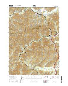
2017 Map of Glendale
USGS Topo · Published 2017About this map
The town of Glendale serves as a primary hub in this southwest Oregon landscape, where the local timber industry is reflected in features like the Superior Log Pond, Twin Harbor Log Pond, and the Glendale Reservoir. The area is characterized by steep drainage basins including Farmer Gulch and Ramsey Gulch, while the railroad infrastructure is marked by several passages such as Tunnel 8 and Tunnel 7 near Wolf Creek. Further south, the settlements of Leland and Sunny Valley occupy the lower reaches of the terrain near Grave Cr. Genealogists will find significant local history at the Glendale Masonic Cem and the Lower Wolf Creek Cem, which sit alongside old thoroughfares like Leland Rd and the Old Stage Rd.
Find a feature on this map
93 named features on this map. Tap any name to fly to it.
Don’t see what you’re looking for? This feature index may not catch every label — zoom into the map to look around manually.
Map Details
Editions of this 2017 Glendale Map
This is the sole edition of this map. No revisions or reprints were ever made.
Other maps of this area

1904 · Riddle
USGS Topo · 1:125,000

1946 · Galice
USGS Topo · 1:62,500

1946 · Dutchman Butte
USGS Topo · 1:62,500

1948 · Galice
USGS Topo · 1:62,500

1948 · Dutchman Butte
USGS Topo · 1:62,500

1954 · Glendale
USGS Topo · 1:62,500

1954 · Canyonville
USGS Topo · 1:62,500

1955 · Medford
USGS Topo · 1:250,000

1957 · Medford
USGS Topo · 1:250,000

1958 · Medford
USGS Topo · 1:250,000