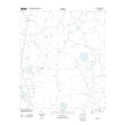
2012 Map of Glendale
USGS Topo · Published 2012About this map
Glendale serves as the primary hub in this portion of Walton County, where the intersection of Hayes Rd and Co Hwy-183B marks a landscape defined by small settlements and numerous water bodies. The terrain is crisscrossed by a dense network of creeks and branches, including Gum Cr and Sandy Cr, which feed into various ponds and lakes. Distinct communities such as Pleasant Grove, Center Ridge, and Union are connected by rural routes, reflecting a settlement pattern centered on local transit and agricultural proximity.
Find a feature on this map
107 named features on this map. Tap any name to fly to it.
Don’t see what you’re looking for? This feature index may not catch every label — zoom into the map to look around manually.
Map Details
Editions of this 2012 Glendale Map
This is the sole edition of this map. No revisions or reprints were ever made.
Other maps of this area

1935 · De Funiak Springs
USGS Topo · 1:48,000

1938 · De Funiak Springs
USGS Topo · 1:62,500

1948 · Ponce De Leon
USGS Topo · 1:24,000

1949 · Glendale
USGS Topo · 1:62,500

1949 · Hobbs Crossroads
USGS Topo · 1:24,000

1950 · Hobbs Cross Roads
USGS Topo · 1:24,000

1950 · Prosperity
USGS Topo · 1:24,000

1950 · Ponce De Leon
USGS Topo · 1:24,000

1951 · Glendale
USGS Topo · 1:62,500

1954 · Tallahassee
USGS Topo · 1:250,000