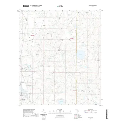
2021 Map of Glendale
USGS Topo · Published 2021About this map
Glendale and the surrounding pine-dotted wetlands of Walton County are captured in this modern survey, revealing a landscape defined by an intricate network of bays, ponds, and creeks. The area north of Defuniak Springs is dominated by significant water bodies such as Juniper Lake and Lake Cassidy, while smaller features like Brim Pond, Bull Pond, and Richland Pond pepper the interior. Local history is anchored by the presence of Pleasant Grove and community landmarks like Ray Cem and Smith Cem.
Find a feature on this map
107 named features on this map. Tap any name to fly to it.
Don’t see what you’re looking for? This feature index may not catch every label — zoom into the map to look around manually.
Map Details
Editions of this 2021 Glendale Map
This is the sole edition of this map. No revisions or reprints were ever made.
Other maps of this area

1935 · De Funiak Springs
USGS Topo · 1:48,000

1938 · De Funiak Springs
USGS Topo · 1:62,500

1948 · Ponce De Leon
USGS Topo · 1:24,000

1949 · Glendale
USGS Topo · 1:62,500

1949 · Hobbs Crossroads
USGS Topo · 1:24,000

1950 · Hobbs Cross Roads
USGS Topo · 1:24,000

1950 · Prosperity
USGS Topo · 1:24,000

1950 · Ponce De Leon
USGS Topo · 1:24,000

1951 · Glendale
USGS Topo · 1:62,500

1954 · Tallahassee
USGS Topo · 1:250,000