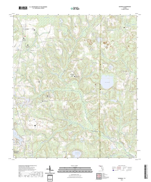
2024 Map of Glendale
USGS Topo · Published 2024About this map
Glendale and Pleasant Grove serve as the primary anchors for this northern Walton County landscape, where the terrain is defined by a dense network of blackwater streams and cypress-fringed ponds. Small country churches and their associated burying grounds, such as the Glendale Presbyterian Church Cem and the Pleasant Grove Baptist Church Cem, highlight the area's rural settlement pattern. The landscape is heavily influenced by the drainage basins of Gum Creek and Sandy Creek, which feed into larger bodies like Lake Cassidy and Juniper Lake.
Find a feature on this map
117 named features on this map. Tap any name to fly to it.
Don’t see what you’re looking for? This feature index may not catch every label — zoom into the map to look around manually.
Map Details
Editions of this 2024 Glendale Map
This is the sole edition of this map. No revisions or reprints were ever made.
Other maps of this area

1935 · De Funiak Springs
USGS Topo · 1:48,000

1938 · De Funiak Springs
USGS Topo · 1:62,500

1948 · Ponce De Leon
USGS Topo · 1:24,000

1949 · Glendale
USGS Topo · 1:62,500

1949 · Hobbs Crossroads
USGS Topo · 1:24,000

1950 · Hobbs Cross Roads
USGS Topo · 1:24,000

1950 · Prosperity
USGS Topo · 1:24,000

1950 · Ponce De Leon
USGS Topo · 1:24,000

1951 · Glendale
USGS Topo · 1:62,500

1954 · Tallahassee
USGS Topo · 1:250,000