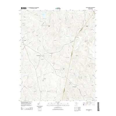
2014 Map of Glenn Springs
USGS Topo · Published 2014About this map
Glenn Springs and the surrounding Upcountry landscape appear here during a period of modern stability, where historical land divisions and local family legacy are still clearly etched into the terrain. The map detail highlights a network of rural settlements including Pauline, Camp Hill, and West Springs, many centered around historic crossroads and water sources like Fairforest Creek and Wiley Fork Cr. Numerous small cemeteries, such as the Frye-Smith-Whiteside Cem and Oeland Cem, offer vital clues for genealogists tracking early Piedmont families.
Find a feature on this map
110 named features on this map. Tap any name to fly to it.
Don’t see what you’re looking for? This feature index may not catch every label — zoom into the map to look around manually.
Map Details
Editions of this 2014 Glenn Springs Map
This is the sole edition of this map. No revisions or reprints were ever made.
Other maps of this area

1941 · Spartanburg
USGS Topo · 1:250,000

1947 · Spartanburg
USGS Topo · 1:62,500

1949 · Spartanburg
USGS Topo · 1:24,000

1949 · Spartanburg
USGS Topo · 1:62,500

1953 · Spartanburg
USGS Topo · 1:250,000

1960 · Spartanburg
USGS Topo · 1:250,000

1963 · Spartanburg
USGS Topo · 1:250,000

1964 · Spartanburg
USGS Topo · 1:250,000

1969 · Cross Anchor
USGS Topo · 1:24,000
1969 · Pacolet Mills
USGS Topo · 1:24,000