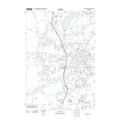
2013 Map of Glens Falls
USGS Topo · Published 2013About this map
The Hudson River defines the industrial and geographic character of this region, separating the core of West Glens Falls and South Glens Falls. The river's historical role in transportation is underscored by the Glens Falls Feeder Canal, which runs parallel to the bank near Pruyns Island. Residential development is dense in the valley, with neighborhoods like Pruyn Crest, Pine Valley, and Gregory Manor expanding toward the southern slopes of French Mountain and Palmertown Mountain.
Find a feature on this map
51 named features on this map. Tap any name to fly to it.
Don’t see what you’re looking for? This feature index may not catch every label — zoom into the map to look around manually.
Map Details
Editions of this 2013 Glens Falls Map
This is the sole edition of this map. No revisions or reprints were ever made.
Other maps of this area

1895 · Glens Falls
USGS Topo · 1:62,500

1897 · Glens Falls
USGS Topo · 1:62,500

1900 · Schuylerville
USGS Topo · 1:62,500

1902 · Saratoga
USGS Topo · 1:62,500

1903 · Luzerne
USGS Topo · 1:62,500

1935 · Gansevoort
USGS Topo · 1:24,000
1935 · Fort Miller
USGS Topo · 1:24,000

1935 · Corinth
USGS Topo · 1:24,000

1938 · Glens Falls
USGS Topo · 1:62,500
1940 · Schuylerville
USGS Topo · 1:62,500