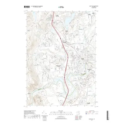
2019 Map of Glens Falls
USGS Topo · Published 2019About this map
The Hudson River carves a path between the Luzerne Mountains and the Palmertown Range in this detailed 2019 survey of the Glens Falls area. This region is defined by its transition from the steep terrain of French Mountain and Darling Mtn to the industrial and suburban landscapes of Glens Falls and South Glens Falls. The presence of the Glens Falls Feeder Canal reflects the historical importance of water-based infrastructure in the area, which continues to shape the local geography alongside modern institutions like SUNY Adirondack Community College.
Find a feature on this map
48 named features on this map. Tap any name to fly to it.
Don’t see what you’re looking for? This feature index may not catch every label — zoom into the map to look around manually.
Map Details
Editions of this 2019 Glens Falls Map
This is the sole edition of this map. No revisions or reprints were ever made.
Other maps of this area

1895 · Glens Falls
USGS Topo · 1:62,500

1897 · Glens Falls
USGS Topo · 1:62,500

1900 · Schuylerville
USGS Topo · 1:62,500

1902 · Saratoga
USGS Topo · 1:62,500

1903 · Luzerne
USGS Topo · 1:62,500

1935 · Gansevoort
USGS Topo · 1:24,000
1935 · Fort Miller
USGS Topo · 1:24,000

1935 · Corinth
USGS Topo · 1:24,000

1938 · Glens Falls
USGS Topo · 1:62,500
1940 · Schuylerville
USGS Topo · 1:62,500