
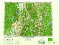
1959 Map of Glens Falls
USGS Topo · Published 1959About this map
Lake George serves as a central landmark in this mid-century view of the borderlands between the Adirondack Mountains and the Green Mountain National Forest. The map captures a post-war landscape defined by established industrial corridors and natural preserves, where the Hudson River flows south through Glens Falls and Fort Edward. This regional survey highlights the transportation networks connecting New York and Vermont, showing the rugged topography that dictated the placement of towns like Ticonderoga and Rutland.
Find a feature on this map
82 named features on this map. Tap any name to fly to it.
Don’t see what you’re looking for? This feature index may not catch every label — zoom into the map to look around manually.
Map Details
Editions of this 1959 Glens Falls Map
2 editions found
Other maps of this area

1889 · Wilmington
USGS Topo · 1:62,500

1891 · Wilmington
USGS Topo · 1:62,500

1891 · Brattleboro
USGS Topo · 1:62,500

1891 · Rutland
USGS Topo · 1:62,500

1893 · Wallingford
USGS Topo · 1:62,500

1893 · Brattleboro
USGS Topo · 1:62,500

1893 · Cohoes
USGS Topo · 1:62,500

1893 · Schenectady
USGS Topo · 1:62,500

1893 · Rutland
USGS Topo · 1:62,500

1893 · Fort Ann
USGS Topo · 1:62,500