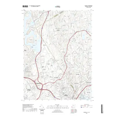
2018 Map of Glenville
USGS Topo · Published 2018About this map
The Byram River and Blind Brook carve through the borderlands of New York and Connecticut in this 2018 survey, highlighting a landscape defined by institutional campuses and residential hamlets. Educational hubs like Manhattanville College and SUNY at Purchase College occupy significant acreage in Purchase, while the Westchester County Airport serves as a modern transportation anchor along the state line. To the east, Fairfield Co is marked by the sprawling estates of Greenwich and the community of Glenville.
Find a feature on this map
319 named features on this map. Tap any name to fly to it.
Don’t see what you’re looking for? This feature index may not catch every label — zoom into the map to look around manually.
Map Details
Editions of this 2018 Glenville Map
This is the sole edition of this map. No revisions or reprints were ever made.
Other maps of this area

1891 · Harlem
USGS Topo · 1:62,500

1892 · Stamford
USGS Topo · 1:62,500

1892 · Tarrytown
USGS Topo · 1:62,500

1893 · Stamford
USGS Topo · 1:62,500

1893 · Tarrytown
USGS Topo · 1:62,500

1897 · Harlem
USGS Topo · 1:62,500

1897 · Oyster Bay
USGS Topo · 1:62,500

1898 · Harlem
USGS Topo · 1:62,500

1898 · Oyster Bay
USGS Topo · 1:62,500

1899 · Stamford
USGS Topo · 1:62,500