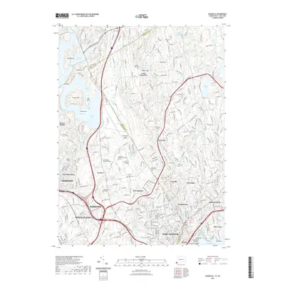
2021 Map of Glenville
USGS Topo · Published 2021About this map
Westchester County Airport sits at the heart of this modern survey, marking the intersection of regional infrastructure and the suburban landscape along the border of New York and Connecticut. The map illustrates the dense residential and educational development that has defined the early 21st century, including the campuses of SUNY at Purchase College and Manhattanville College. While major transit routes like the Mamaroneck River and numerous ponds shape the topography, the historical record remains visible through a high concentration of family and community burial grounds, such as Pecks Cem, Howe Cem, and Green Cem. These small cemeteries, scattered from Riversville to Purchase, offer grounded points of reference for genealogists amidst the modern expansion of Harrison, White Plains, and Greenwich.
Find a feature on this map
300 named features on this map. Tap any name to fly to it.
Don’t see what you’re looking for? This feature index may not catch every label — zoom into the map to look around manually.
Map Details
Editions of this 2021 Glenville Map
This is the sole edition of this map. No revisions or reprints were ever made.
Other maps of this area

1891 · Harlem
USGS Topo · 1:62,500

1892 · Stamford
USGS Topo · 1:62,500

1892 · Tarrytown
USGS Topo · 1:62,500

1893 · Stamford
USGS Topo · 1:62,500

1893 · Tarrytown
USGS Topo · 1:62,500

1897 · Harlem
USGS Topo · 1:62,500

1897 · Oyster Bay
USGS Topo · 1:62,500

1898 · Harlem
USGS Topo · 1:62,500

1898 · Oyster Bay
USGS Topo · 1:62,500

1899 · Stamford
USGS Topo · 1:62,500