Loading...
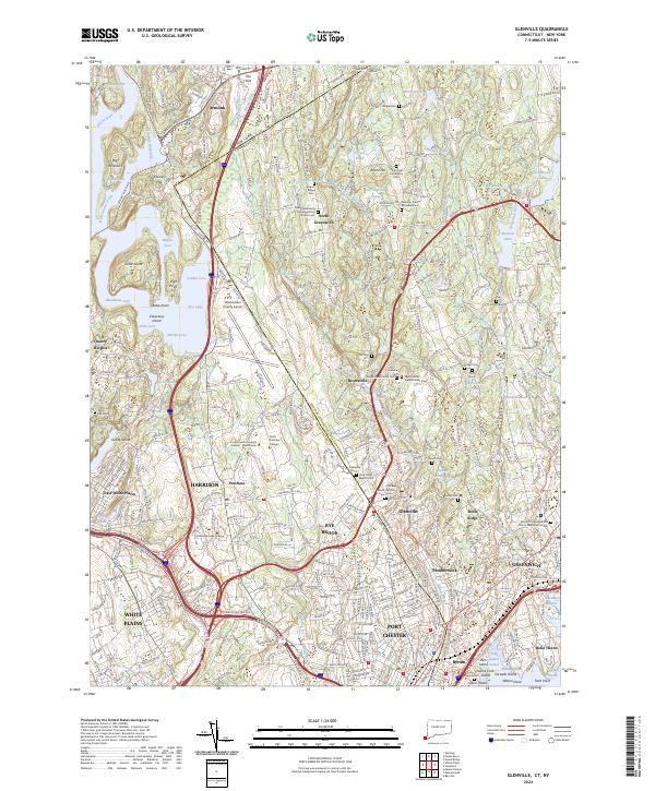
Loading map...2024 Map of Glenville
USGS Topo · Published 2024About this map
Westchester County Airport sits at the heart of this landscape, straddling the state line where New York and Connecticut meet. This 2024 survey captures a sophisticated suburban and institutional corridor defined by major campuses such as SUNY Purchase College and Manhattanville College. The terrain is marked by the high elevations of Quaker Ridge and the engineered path of the Delaware Aqueduct, which cuts through the region toward the city.
Find a feature on this map
344 named features on this map. Tap any name to fly to it.
Don’t see what you’re looking for? This feature index may not catch every label — zoom into the map to look around manually.
Map Details
Date Portrayed2024
Date Published2024
PublisherU.S. Geological Survey
Map TypeTopographic
Scale1:24000
Physical Dimensions24 x 29 inches
Editions of this 2024 Glenville Map
This is the sole edition of this map. No revisions or reprints were ever made.
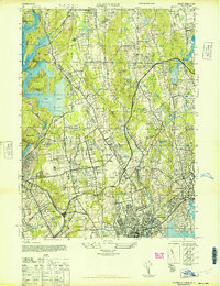
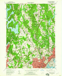
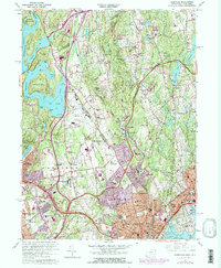
Historical Maps of Pine Hill Through Time
4 maps found
Featured Locations
Source Details
SourceU.S. Geological Survey
CopyrightPublic Domain