
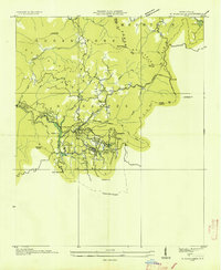
1935 Map of Glenville
USGS Topo · Published 1935About this map
Glenville and the surrounding high country of the Cullowhee Mountains are captured here in 1935, just as the Tennessee Valley Authority was conducting advanced surveys of the Tuckasegee River basin. This topographic record shows the area before major hydroelectric developments transformed the river valley. The landscape is defined by small, isolated settlements like Erastus, Bessie, and Snookville, each connected by narrow trails and the emerging State Highway No 106.
Find a feature on this map
85 named features on this map. Tap any name to fly to it.
Don’t see what you’re looking for? This feature index may not catch every label — zoom into the map to look around manually.
Map Details
Editions of this 1935 Glenville Map
This is the sole edition of this map. No revisions or reprints were ever made.
Other maps of this area

1891 · Cowee
USGS Topo · 1:125,000

1897 · Cowee
USGS Topo · 1:125,000

1907 · Cowee
USGS Topo · 1:125,000

1933 · Bryson
USGS Topo · 1:62,500

1935 · Cashiers
USGS Topo · 1:24,000

1935 · Tuckaseigee
USGS Topo · 1:24,000

1935 · Cullowhee
USGS Topo · 1:24,000

1935 · Scaly
USGS Topo · 1:24,000

1935 · Corbin Knob
USGS Topo · 1:24,000
1935 · Highlands
USGS Topo · 1:24,000