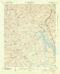
1947 Map of Glenville
USGS Topo · Published 1947About this map
The high elevation waters of Glenville Lake dominate this Jackson County landscape, reflecting the post-war industrial footprint within the Nantahala National Forest. Following the 1946 field examination by the Tennessee Valley Authority, this map details the critical infrastructure of the era, including the Glenville Dam, a hydroelectric tunnel, and a power plant on the Tuckasegee River. These modern additions sit alongside traditional mountain settlements and landmarks like Erastus, Bessie, and Shookville.
Find a feature on this map
104 named features on this map. Tap any name to fly to it.
Don’t see what you’re looking for? This feature index may not catch every label — zoom into the map to look around manually.
Map Details
Editions of this 1947 Glenville Map
2 editions found
Other maps of this area

1891 · Cowee
USGS Topo · 1:125,000

1897 · Cowee
USGS Topo · 1:125,000

1907 · Cowee
USGS Topo · 1:125,000

1933 · Bryson
USGS Topo · 1:62,500

1935 · Cashiers
USGS Topo · 1:24,000

1935 · Tuckaseigee
USGS Topo · 1:24,000

1935 · Cullowhee
USGS Topo · 1:24,000

1935 · Scaly
USGS Topo · 1:24,000

1935 · Glenville
USGS Topo · 1:24,000

1935 · Corbin Knob
USGS Topo · 1:24,000