
2024 Map of Glenwood
USGS Topo · Published 2024About this map
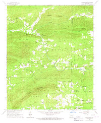
The Caddo River and its South Fork define the landscape where the Cossatot Mountains meet the river valley. The town of Glenwood serves as a central hub, situated along Sweetwater Creek and the main river bend, showing a detailed network of streets and local services. Further south and west, smaller communities like Salem, Kirby, and Rosboro are scattered across the terrain, connected by rural routes such as Thunder Mountain Rd and Caddo Valley Rd.
Find a feature on this map
157 named features on this map. Tap any name to fly to it.
Don’t see what you’re looking for? This feature index may not catch every label — zoom into the map to look around manually.
Map Details
Editions of this 2024 Glenwood Map
This is the sole edition of this map. No revisions or reprints were ever made.
Other maps of this area

1906 · Caddo Gap
USGS Topo · 1:125,000

1936 · Glenwood
USGS Topo · 1:48,000

1942 · Glenwood
USGS Topo · 1:62,500

1943 · Antoine
USGS Topo · 1:62,500

1949 · Glenwood
USGS Topo · 1:62,500

1955 · Little Rock
USGS Topo · 1:250,000

1956 · Little Rock
USGS Topo · 1:250,000

1960 · Little Rock
USGS Topo · 1:250,000

1964 · Little Rock
USGS Topo · 1:250,000
1966 · Bonnerdale
USGS Topo · 1:24,000