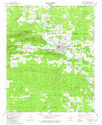
1979 Map of Glenwood
USGS Topo · Published 1980About this map
Glenwood sits at the heart of this Arkansas landscape, where the Caddo River winds through the Cossatot Mountains and Ouachita National Forest. The late 1970s infrastructure is clearly defined, showing the Missouri Pacific railroad corridor alongside mid-century local landmarks like a Drive-in Theater and a Landing Strip north of the river.
Find a feature on this map
44 named features on this map. Tap any name to fly to it.
Don’t see what you’re looking for? This feature index may not catch every label — zoom into the map to look around manually.
Map Details
Editions of this 1979 Glenwood Map
This is the sole edition of this map. No revisions or reprints were ever made.
Other maps of this area

1906 · Caddo Gap
USGS Topo · 1:125,000

1936 · Glenwood
USGS Topo · 1:48,000

1942 · Glenwood
USGS Topo · 1:62,500

1943 · Antoine
USGS Topo · 1:62,500

1949 · Glenwood
USGS Topo · 1:62,500

1955 · Little Rock
USGS Topo · 1:250,000

1956 · Little Rock
USGS Topo · 1:250,000

1960 · Little Rock
USGS Topo · 1:250,000

1964 · Little Rock
USGS Topo · 1:250,000
1966 · Bonnerdale
USGS Topo · 1:24,000